 US: 2-4 weeks,
  Europe: 1-2 weeks, 🌍 Worldwide: 1-4 weeks ✈️
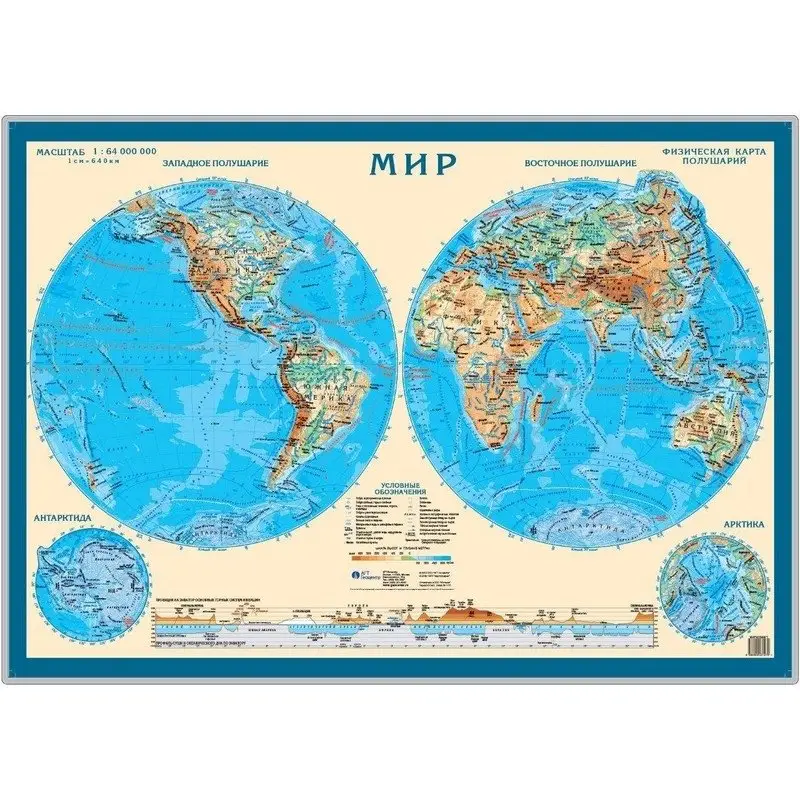
Физическая карта мира. Карта полушарий. Настольная карта | Physical World Map. Hemisphere Map. Desk Map
Физическая карта мира. Карта полушарий. Настольная карта
Обзор
Представляем настольную физическую карту, охватывающую Западное и Восточное полушария Земли. Карта детально отображает рельеф суши и дно океанов с использованием гипсометрической окраски. Для наглядного сравнения высот основных горных систем и глубин океанов, под картой размещен профиль суши и океанического дна вдоль экватора. Этот профиль включает проекцию ключевых горных систем и вершин.
Кому подойдёт
- Учащимся и студентам для изучения географии.
- Путешественникам и любителям географии.
- Для оформления кабинета или учебного класса.
Ключевые особенности
- Физическая карта Западного и Восточного полушарий.
- Рельеф суши и дна океанов показан гипсометрической окраской.
- Профиль суши и дна океана по экватору с проекцией горных систем.
- Масштаб: 1:64 000 000.
- Размер: 590x420 мм.
- Производитель: Гео-Трейд.
Physical World Map. Hemisphere Map. Desk Map
Overview
This desk map presents the Western and Eastern hemispheres of the Earth. It clearly depicts land and ocean floor topography through hypsometric coloring. To facilitate comparison of major mountain heights and ocean depths, a profile of the land and ocean floor along the equator is included below the map. This profile features projections of significant mountain systems and peaks.
Who it's for
- Students learning geography.
- Travel enthusiasts and geography buffs.
- For decorating an office or classroom.
Key features
- Physical map of the Western and Eastern hemispheres.
- Land and ocean floor relief shown with hypsometric coloring.
- Equatorial profile of land and ocean floor with mountain system projections.
- Scale: 1:64,000,000.
- Dimensions: 590x420 mm.
- Manufacturer: Geo-Trade.