 US: 2-4 weeks,
  Europe: 1-2 weeks, 🌍 Worldwide: 1-4 weeks ✈️
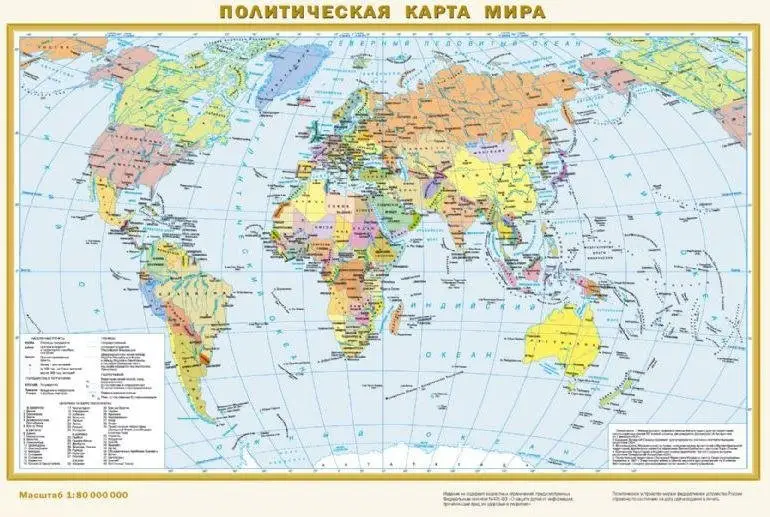
Физическая карта мира. Политическая карта мира. Наглядное пособие. 440x290 мм | Physical and Political World Map - 440x290 mm
Физическая карта мира. Политическая карта мира. Наглядное пособие. 440x290 мм
АСТ, 2021
Обзор
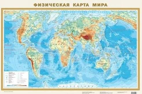
Эта двусторонняя карта формата А3 размером 440x290 мм предлагает подробное изучение мира. Одна сторона представляет физическую карту с рельефом суши и дна океана, отображая горы, равнины, реки, озера, хребты, котловины и течения. Высочайшие вершины отмечены высотными отметками. На другой стороне расположена политическая карта, показывающая все независимые государства, их столицы, а также территории с особым статусом. Населенные пункты классифицированы по численности населения.
Кому подойдёт
- Широкому кругу пользователей
- Учащимся и студентам
- Путешественникам и исследователям
Ключевые особенности
- Двусторонняя карта мира
- Физический и политический обзор
- Размеры: 440x290 мм
- Масштаб: 1:80 000 000
- Издательство: АСТ
- Год издания: 2021
- Язык: Русский
- Количество страниц: 2
Physical and Political World Map - 440x290 mm
AST, 2021
Overview
This double-sided A3 map, measuring 440x290 mm, offers a comprehensive view of the world. One side features a physical map detailing land and ocean floor topography, including mountains, plains, rivers, lakes, ridges, basins, and currents. The highest peaks are marked with elevation points. The reverse side presents a political map, illustrating all independent nations, their capitals, and territories with special status. Settlements are categorized by population size.
Who it's for
- A wide range of users
- Students and learners
- Travelers and researchers
Key features
- Double-sided world map
- Physical and political overview
- Dimensions: 440x290 mm
- Scale: 1:80,000,000
- Publisher: AST
- Year: 2021
- Language: Russian
- Pages: 2